With Parks on the Air (POTA) becoming a relatively new thing in the UK, I decided to activate a few local parks. It quickly became apparent that many of the local parks had never been activated before. I decided that I would concentrate on those.
I suspect that they hadn’t been activated before because they required a bit of a walk to get to. What with it being winter and wanting to get out of the house, I kitted up my backpack with my Icom IC-705, my EcoWorthy 8Ah LiFePo4 battery (see my notes on IC705 power vs voltage) and a few antenna options. Over the course of a few evenings, heading to a different park each night after work, I activated the parks I had seen on the POTA App Map. I wanted a way to find any parks that were local, but that hadn’t been activated.
With services like SOTL.AS for Summits on the Air (SOTA), it’s easy to filter the map to only show specific things, like removing summits you’ve activated, or setting a minimum number of activator points, or showing only summits that haven’t been activated before. Unfortunately no such service exists for POTA (yet). If you’re reading this and considering doing something similar, check out SOTLAS first 🙂
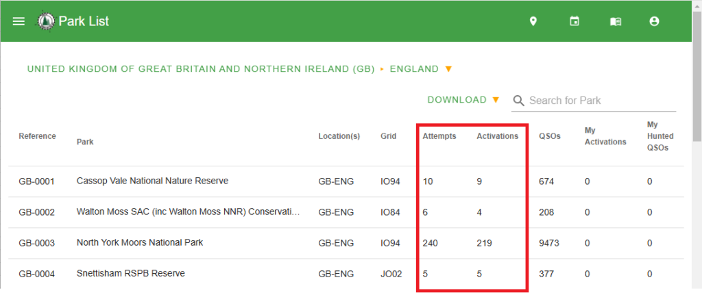
The POTA website does offer all_parks.csv (list of all POTAs) and all_parks_ext.csv (list of all POTAs with location information). However, neither of these files have the information I was looking for: the number of activations or attempted activations. Disappointing, but I didn’t give up that easily! I did some digging!
By searching the POTA ParkList for parks in my country, in my case “GB-ENG”, I was able to see the information I needed. At this stage, you could just sort the columns by activations, and skim through looking for close places. However, I wanted to do better than that! I wanted to create a program that would list them by how close they were to me.
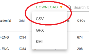
The observant amongst us will have noticed the “DOWNLOAD” button, that yields a CSV file for us. You may have to be logged in to see this, as it contains information personal to you (your activations, and hunts). I missed this the first time and subsequently copied and pasted the information manually from the webpage into a spreadsheet and exported it to a CSV which took about 5 minutes!
Regardless of how you chose to obtain the information, you’ll end up with a CSV file. Mine was called “England.csv”. The data inside is really useful and includes the latitude and longitude of each marker. Any program would just need to work out how far each site is from a given location (say, your home QTH) and then sort the output by distance. It could filter on attempts or activations, too.
The Program
So I set about writing a simple Python program (really more of a script) that lets you explore your POTA CSV file and (most importantly for me) find the closest unactivated POTA parks.
The code can be found on GitHub: https://github.com/m1geo/POTA-Finder. It runs in a command terminal window on any OS that will run Python3. It has a simple help function, and minimal error checking as it was an evening project. The source code should be easy enough to tinker with should you wish to add, change, remove functionality.
Calling the program with the -h help flag will output the above information to help you get started. You can set the --max-activations to 0 to show unactivated parks, like this:
You can also use the shorter command-line options as below, and supply a lat/long as here:
And with that, you can pack your kit in the car and head out for a POTA activation…


